Skip to content Skip to footer
-29%

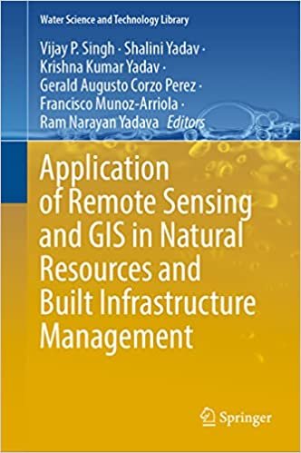
Application of Remote Sensing and GIS in Natural Resources and Built Infrastructure Management

Original price was: ₨3,500.00.Current price is: ₨2,500.00.

  1. Transformative Exploration: “Application of Remote Sensing and GIS in Natural Resources and Built Infrastructure Management” beckons readers on a transformative journey into cutting-edge technologies. Crafted by leading experts, the book goes beyond conventional boundaries, providing a holistic perspective on the collaborative applications of Remote Sensing (RS) and Geographic Information Systems (GIS). This comprehensive guide navigates the intricate interplay between technology and the environment, heralding a new era in resource management and urban planning.
  2. Accessible Design: A testament to thoughtful design and accessibility, the book is meticulously prepared in both color matte finish and black-and-white formats. This consideration ensures that the content resonates with a diverse audience. The vibrant color illustrations bring to life the intricate details of RS and GIS applications, rendering abstract concepts tangible. Simultaneously, the black-and-white rendition maintains clarity and readability. This design choice underscores the commitment to accessibility, enabling readers, whether specialists or enthusiasts, to engage with the material in a manner that suits their preferences.
  3. Rich Tapestry of Topics: Delving into the pages reveals a rich tapestry of topics, spanning from fundamental principles to diverse applications of RS and GIS in natural resource management and urban infrastructure. The authors guide readers through a nuanced narrative, showcasing how these technologies have revolutionized the monitoring, analysis, and management of Earth’s resources. Whether tracking deforestation patterns, assessing water quality, or optimizing urban development, the book stands as a comprehensive guide for professionals, researchers, and policymakers seeking to harness the full potential of RS and GIS for a sustainable and resilient future.
  4. A Roadmap to the Future: More than a collection of academic insights, this book serves as a roadmap to the future of resource management and urban planning. With a blend of technical depth, practical relevance, and thoughtful design, it sets a new standard in the literature of RS and GIS applications. It emerges as an indispensable resource for those passionate about leveraging technology to address the intricate challenges of natural resource conservation and sustainable urban development. This guide propels readers towards a future where data-driven decisions shape a more resilient and environmentally conscious world.
  5. Guiding Sustainability: “Application of Remote Sensing and GIS in Natural Resources and Built Infrastructure Management” is not just a guidebook; it is a beacon for individuals enthusiastic about guiding sustainability through technological advancements. Its innovative approach and comprehensive insights make it an essential resource for anyone eager to play a role in shaping a future where RS and GIS applications drive informed decisions, fostering a world where resource management and urban planning align with principles of sustainability and resilience.

Additional information

Description

Application of Remote Sensing and GIS in Natural Resources and Built Infrastructure Management

Embark on a transformative exploration of cutting-edge technologies with the comprehensive guide, “Application of Remote Sensing and GIS in Natural Resources and Built Infrastructure Management.” Meticulously curated by leading experts in the field, this book transcends traditional boundaries, offering a holistic perspective on the synergistic applications of Remote Sensing (RS) and Geographic Information Systems (GIS). From deciphering the complex dynamics of natural resources to optimizing the management of built infrastructure, this groundbreaking volume navigates the intricate interplay of technology and the environment, unlocking a new era in resource management and urban planning.

Beyond its scholarly contributions, the book is a testament to thoughtful design and accessibility. The material is being prepared in both color matte finish and black-and-white formats, ensuring that the content caters to a diverse audience. The vibrant color illustrations illuminate the intricate details of RS and GIS applications, making abstract concepts tangible, while the black-and-white rendition maintains clarity and readability. This design choice reflects the commitment to accessibility, ensuring that readers, whether specialists or enthusiasts, can engage with the material in a way that suits their preferences.

As readers delve into the pages, they encounter a rich tapestry of topics, ranging from the fundamental principles of RS and GIS to their diverse applications in natural resource management and urban infrastructure. The authors guide readers through a nuanced narrative, illustrating how these technologies have revolutionized our ability to monitor, analyze, and manage the Earth’s resources. Whether it’s tracking deforestation patterns, assessing water quality, or optimizing urban development, the book stands as a comprehensive guide for professionals, researchers, and policymakers seeking to harness the full potential of RS and GIS in shaping a sustainable and resilient future.

“Application of Remote Sensing and GIS in Natural Resources and Built Infrastructure Management” is not just a collection of academic insights; it is a roadmap to the future of resource management and urban planning. With its blend of technical depth, practical relevance, and thoughtful design, this book sets a new standard in the literature of RS and GIS applications. It emerges as an indispensable resource for anyone passionate about leveraging technology to address the intricate challenges of natural resource conservation and sustainable urban development, guiding readers towards a future where data-driven decisions shape a more resilient and environmentally conscious world.

Reviews

There are no reviews yet.

Be the first to review “Application of Remote Sensing and GIS in Natural Resources and Built Infrastructure Management”

Your email address will not be published. Required fields are marked *

Stay in Touch with Our Updates

[mc4wp_form id="461" element_id="style-4"]

O level A level books  © 2024. All Rights Reserved.